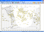
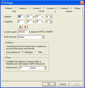
 Home - Provides a means of setting the Home location in the Map display. The Home location becomes a reference point for the map.
Defining:
There are two options for defining your Home location. One is to enter location co-ordinates and the other is to enter a Maidenhead Locator code.
Regardless of which method is used, there is an arrow button to convert one input into the other.
Show home loc: provides a choice of showing the home location Always or Only when plotting.
Distance Group:
Displayed distances from the home location are updated as you move the mouse over the map. You can choose whether to have these distances in kilometres or miles.
Power Group:
The map also has a display for distances in kilometres per Watt at the bottom right corner of the display - mainly for QRP enthusiasts. Enter your output power and then select Watts or milliWatts from the drop down selection. The values will be converted to kilometres per watt for display purposes.